 IMAS Metadata Catalogue
Type of resources
Topics
Keywords
Contact for the resource
Provided by
Years
-
This dataset consists of data collected by the real-time dissolved oxygen (DO) monitoring system in Macquarie Harbour, Tasmania, originally established under the Sense-T program, continued under FRDC project 2016-067 and deployed and maintained by IMAS. The system consists of 3 strings of acoustically telemetered, optical fluorescence DO, temperature and depth sensors (VEMCO, Bedford, Canada) which measure DO in % saturation, temperature in °C and depth in meters. The dataset spanning the time period from the 1st of January 2017 to the 19th of April 2017 consists of data collected using the first generation of sensors as described above. Subsequent quarterly updates from the 3rd of June 2017 onwards consist of data collected using the new generation of tags which contain a tilt instead of a depth sensor.
-

This record provides an overview of the NESP Marine and Coastal Hub project "Ecological outcomes of wastewater discharges in contrasting receiving environments". For specific data outputs from this project, please see child records associated with this metadata. -------------------- Australia’s Waste Policy Action Plan, Threat Abatement Plan for the impacts of marine debris and Australia’s One Health Master Action Plan all refer to the need for emerging pollutants to be incorporated into contaminant guidelines. Wastewater treatment plants currently report on a limited number of contaminants and lack consistent testing requirements. NESP MaC Scoping Study 1.16 has determined there is a clear and consistent need for data on environmental concentrations of emerging contaminants and an assessment of their impact on ecological communities. This project aims to determine the concentration of emerging pollutants in different wastewater outfall settings, and assess where environmental impacts are greatest. It will also continue to collate, analyse and maintain the information from Water Treatment Authorities on outfall flows, pollutant concentrations and loads and presented annually within the National Outfalls Database. Outputs • Measures of CEC (contaminants of emerging concern) in water samples taken from outfall sites [dataset] • Final project report [written]
-
This database contains sampling effort, catch records, biological data, and water quality data for sampling and catches of elasmobranchs in northern Australian rivers, estuaries and coasts undertaken under the National Environmental Research Program (NERP) Marine Biodiversity Hub Project 2.4 'Supporting Management of Listed and Rare Species'. and the National Environmental Science Program (NESP) Marine Biodiversity Hub Project A1 'Northern Australian Hotspots for the Recovery of Threatened Euryhaline Elasmobranchs'. Surveys using gillnets and rod-and-line were undertaken in the Top End region of the Northern Territory and the Kimberley region of Western Australia. Selected animals were tagged for movement ecology, habitat use and mortality estimates (acoustic telemetry), and tissue samples were collected from all fish for molecular analyses (population genetics and close-kin mark-recapture).
-
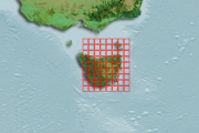
The MOU74 Box, off the northwest Australian coastline, is an area of approximately 50,000 sq. km within the Australian Fishing Zone. It contains five large, shallow reef systems (less than 15 m deep) ranging in size from 227 sq. km (Ashmore Reef) to 4.5 sq. km (Browse Island). They total approximately 560 sq. km in area. Immediately north of the MOU74 Box within the Australian Fishing Zone (Little Area A) is another shallow reef, Hibernia Reef. In addition to the shallow reefs, there is approximately 925 sq. km of shoal areas (15 to 50 m deep) within the MOU74 Box and 301 sq. km of shoal areas in Little Area A. The reefs and shoals support populations of sedentary reef resources including several species of holothurians (beche-de-mer, sea cucumbers) and trochus, as well as reef-associated fin-fish and sharks. These resources have been fished for many years by Indonesian fishers. Ashmore Reef was declared a Marine Nature Reserve in 1983, banning the removal of fauna and flora to a depth of 50 m. The remaining reefs in the area are under continued, and probably increasing, fishing pressure. The marine resources of the MOU74 Box are managed by the Australian Government. Under the terms of a memorandum of understanding (MOU) between the Australian and Indonesian governments, continued traditional fishing by Indonesian fishing vessels is allowed, principally for sedentary resources such as beche-de-mer (trepang) and trochus, but also fin-fish and reef shark. Apart from limited catch data collected by surveillance and regulatory authorities, little is known about the catch of the Indonesian fishers and the effects of fishing on the target species. There are concerns that the current level of fishing may be unsustainable. In September and October 1998, CSIRO Division of Marine Resources surveyed the shallow reefs (0-15 m deep) and shoal areas (15-50 m deep) of the MOU74 Box area and Little Area A to the north. Its purpose was to assess the status of the reef resources in the area, and the environment that supports them. Fieldwork for the survey was completed on 10 October 1998. Overall, the sedentary marine living resources on the shallow reefs were heavily depleted with the high-value species over-exploited and the lower value species probably either fully or over-exploited. Despite the low density, there appears to be a sustained fishing effort by Indonesian fishers in the area. A drastic reduction in effort would be required to allow for a recovery of the higher value species, and to protect other species from severe depletion. The exception is Ashmore Reef, where there were significant populations of most target species. However, there is most likely some illegal fishing occurring on Ashmore Reef and there is clear evidence of exploitation of at least the high-value resources. The nature of these fisheries and the depleted state of the other reefs in the MOU74 Box suggests that the remaining resources on Ashmore Reef could be quickly depleted if the protection currently given to the reef is not maintained and possibly enhanced. For many reasons, including the potential for recruitment of larvae to depleted reefs, it is important that these populations are protected. Year round protection of the resources on Ashmore Reef should be considered. This record describes the following survey data for the Timor MOU74 Box: • Classified satellite habitat map for Scott and Seringapatam Reefs. • Classified satellite habitat map for Ashmore, Hibernia and Cartier Reefs.
-
These data were collected on the RV L'Astrolabe (platform code: FHZI) from 11/04/2004 to 11/08/2004 on a trip from Dumont D'Urville to Hobart. Maximum photochemical efficiency of photosystem II (PSII), also called maximum quantum yield of PSII (Fv/Fm), has become one of the most widely utilized fluorescence parameters in phytoplankton research. It represents the potential photochemical efficiency, which is the probability that the light energy captured by the photosynthetic apparatus is being utilized as photochemistry. Fv/Fm has been shown to have an instant response to variations in physical and chemical properties and is interpreted as a diagnostic of the overall health or competence of phytoplankton. Together with the absorption cross section area of PSII and chlorophyll concentration, it can be used to measure primary production (Cheah et al. 2011, Deep Sea Research). Seawater from 3 m depth was supplied continuously from the ship’s clean seawater line. FRR fluorescence yields were measured continuously at 1 minute intervals in dark-adapted state (! 15 minutes dark-adaptation) using a flash sequence consisting of a series of 100 subsaturation flashlets (1.1 μs flash duration and 2.8 μs interflash period) and a series of 20 relaxation flashlets (1.1 μs flash duration and 51.6 μs interflash period).
-
This data presents the results of seabed mapping and habitat classification surveys completed in Darwin Harbour during 2011 and 2013 as part of the Northern Territory Government's marine habitat mapping program. This research is a collaboration between Geoscience Australia (GA), the Australian Institute of Marine Science (AIMS), the Department of Land Resource Management (DLRM) and the Darwin Port Corporation. Key objectives are to: - Produce detailed maps of the bathymetry and derived parameters such as slope and rugosity, - Classify the seabed into areas of hard and soft substrate, and, - Produce seabed habitat maps (or seascapes). Key outcomes from the surveys include: 1. Improved understanding of the seabed of Darwin Harbour. The main seabed geomorphic features identified in Darwin Harbour include banks, ridges, plains and scarps, and a deep central channel that divides into smaller and shallower channels. Acoustically hard substrates are found mostly on banks and are associated with rocky reef and sponge gardens, and are often overlain by a thin veneer of sandy sediment. In contrast, plains and channels are characterised by acoustically soft substrates and are associated with fine sediments (mud and sand). 2. Classification of physical seabed properties to produce a Seascape Map for Darwin Harbour. Six seascape classes (potential habitats) were derived using an Iterative Self Organising (ISO) unsupervised classification scheme. These six classes are related to statistically unique combinations of seabed substrate, relief, bedform and presence of sediment veneer (quite often inferred from presence of epibenthic biota).
-
The final lithospheric breakup of the Australian-Antarctic rift system remains controversial due to sparse geological constraints on the nature of the basement along the ocean-continent transition zones. We present new interpretations of multichannel seismic reflection transects, as well as new petrological data of dredged mantle rocks along the East Antarctic margin (Seamount B, offshore Terre Adélie). By combining both datasets, we show that a 50–100 km wide domain of cold (900°C), fertile subcontinental mantle was exhumed along the non-volcanic Antarctic margin. The dredged peridotites preserve characteristics similar to mantle xenoliths found in syn- to post-rift volcanism at the eastern end of the Australian margin (Victoria and Tasmania), indicating the sampling of a common fertile subcontinental mantle during rifting between Australia and Antarctica. Seamount B represents the initial stages of exhumation of cold subcontinental lithosphere along an ocean-continent transition during rifting. This thick mantle domain was likely affected by syn-rift melt impregnation at high-pressure (8 kbar), leading to the formation of plagioclase-pyroxenites. Overall, the combination of continental rifted blocks, a 50-100 km wide domain of volcanic-poor subcontinental mantle and (ultra)-slow spreading implies that ocean-continent transition zones along the Australian-Antarctic margins represent a recent analogue to ocean continent transition zones from the Jurassic Western Tethys. Additionally, evidence of syn-rift melt stagnation at high pressure suggests that magmatism along the Australian-Antarctic rifted margins was sufficient to form magnetic anomalies that can be used as isochrons despite their formation in lithosphere other than mature, steady-state ocean crust.
-
Five polymorphic microsatellite loci were developed and then used to assess the population genetic structure of a commercially harvested merobenthic octopus species (Octopus maorum) in south-east Australian and New Zealand (NZ) waters. Beak and stylet morphometrics were also used to assess population differentiation in conjunction with the genetic data.
-
Phytoplankton productivity in the polar Southern Ocean (SO) plays an important role in the transfer of carbon from the atmosphere to the ocean’s interior, a process called the biological carbon pump, which helps regulate global climate. SO productivity in turn is limited by low iron, light, and temperature, which restrict the ef- ficiency of the carbon pump. Iron and light can colimit productivity due to the high iron content of the photosynthetic photosystems and the need for increased photosystems for low-light acclimation in many phytoplankton. Here we show that SO phytoplankton have evolved critical adaptations to enhance photosynthetic rates under the joint constraints of low iron, light, and temperature. Under growth-limiting iron and light levels, three SO species had up to sixfold higher photosynthetic rates per photosystem II and similar or higher rates per mol of photosynthetic iron than tem- perate species, despite their lower growth temperature (3 vs. 18 °C) and light intensity (30 vs. 40 μmol quanta·m2·s−1), which should have decreased photosynthetic rates. These unexpectedly high rates in the SO species are partly explained by their unusually large photosynthetic antennae, which are among the largest ever recorded in marine phytoplankton. Large antennae are disadvan- tageous at low light intensities because they increase excitation energy loss as heat, but this loss may be mitigated by the low SO temperatures. Such adaptations point to higher SO production rates than environmental conditions should otherwise permit, with implications for regional ecology and biogeochemistry.
-
Underwater video technology was used to observe marine mammal interactions (seals, in particular Australian fur seals) within midwater trawl nets. A camera system was placed inside the trawl net in the vicinity of a Seal Excluder Device, designed to prevent megafauna from entering the codend of the net and provide an escape point. Digital video data was described according to a range of operational, catch and interaction fields, and made time-specific to each trawl shot. Data is linked to commercial catch and effort data providing operational, environmental and catch information.